The Ring of Kerry — in Irish, Mórchuaird Chiarraí — is a circular driving route around the Iveragh Peninsula in the south-west of Ireland. It runs for roughly 179 kilometres along the N70 and N71 national roads, with a short stretch of the N72 between Killarney and Killorglin. The full loop can be driven in around three and a half hours without stops, but doing it that way misses the point. With detours onto the Skellig Ring and the Gap of Dunloe, and time spent at the heritage sites along the way, the route comfortably fills two or three days.
The Ring forms part of the Wild Atlantic Way, the 2,500-kilometre signed coastal touring route that runs the length of Ireland's western seaboard from Kinsale in County Cork to the Inishowen Peninsula in County Donegal. It is also one of the most-visited driving routes in Ireland: Fáilte Ireland, the national tourism authority, lists it among the country's signature visitor experiences. That popularity is the reason a little planning makes such a difference.
Drive it clockwise
Tour coaches travel the Ring anti-clockwise — Killarney to Killorglin to Cahersiveen to Sneem and back through Kenmare. They do this for a practical reason: on the narrow stretches around Coomakista Pass and along parts of the south coast, an oncoming coach has nowhere to pull in, so the operators agreed long ago to run in the same direction. Independent drivers who set off clockwise — Killarney to Kenmare first — meet the coach traffic head-on and lose time to passing places. Set off in the same direction as the coaches, an hour or two ahead of them (most leave Killarney mid-morning), and the road clears in front of you.
An alternative is to base yourself in Kenmare or Cahersiveen rather than Killarney, and start the loop late in the afternoon when the coaches are heading back. The light on the western stretches between Waterville and Caherdaniel is at its best after about 5pm in summer.
Take the Skellig Ring
At Cahersiveen, a signed detour leaves the main route and runs out through Portmagee, Ballinskelligs and Waterville back onto the N70. This is the Skellig Ring, a narrow coastal road that the larger tour coaches do not use. It takes in the Kerry Cliffs above Portmagee — a working farm where the cliff walk is open to paying visitors during daylight hours — and views across to the Skellig Islands when the weather is clear. The Skellig Ring is itself part of the Wild Atlantic Way and is signed with the same wave-shaped waymarkers.
Between Ballinskelligs and Waterville the road climbs Coomanaspig Pass, one of the highest points reachable by paved road in Ireland. There is a small lay-by at the top.
Skellig Michael
Skellig Michael — in Irish, Sceilg Mhichíl — is the larger of the two Skellig islands. Its early Christian monastic settlement, with drystone beehive cells (clocháin), oratories and a stairway cut into the rock, sits some 180 metres above the Atlantic. The monastery is believed to have been founded between the 6th and 8th centuries and was occupied until the 12th or 13th century. UNESCO inscribed the site on the World Heritage list in 1996.
Landing-tour boats sail from Portmagee between mid-May and the end of September, weather permitting, under a permit system administered by the Office of Public Works (OPW) that limits daily landing numbers. Crossings sell out months in advance. The climb to the monastery is up roughly 600 uneven stone steps with no handrails; the OPW does not recommend the visit for anyone with a fear of heights or limited mobility. Eco tours, which circle the island without landing, are run from Portmagee, Ballinskelligs and Derrynane and generally have availability later in the season.
The Skellig Experience visitor centre on Valentia Island, run by Kerry County Council, gives the full background on the monastery, the lighthouse keepers who lived on the rock, and the seabird colonies. It is open seasonally.
What to stop for
Killarney National Park. Established in 1932 around the Muckross estate after the Bourn-Vincent family gifted the land to the State, it was Ireland's first national park and now extends to roughly 26,000 acres. Muckross House, a 19th-century Tudor-style mansion built for Henry Arthur Herbert, is run by the OPW and open to the public. Within the park, Ladies View and Moll's Gap on the N71 give the panoramas of the Upper, Middle and Lower Lakes of Killarney that appear on most postcards of the area. The park also holds Ireland's only native herd of red deer.
Staigue Stone Fort. A signed three-kilometre detour off the N70 west of Sneem leads to one of the largest and best-preserved ringforts in Ireland. The drystone walls stand up to about 5.5 metres high and 4 metres thick at the base. It is generally dated to the late Iron Age or early medieval period. The site is in State care; there is no formal entry fee, but an honesty box at the gate of the adjoining farm requests a small contribution.
Derrynane House. The ancestral home of Daniel O'Connell — the 19th-century campaigner for Catholic emancipation, often known as "the Liberator" — sits in its own park near Caherdaniel and is run by the OPW. The house, family chapel and grounds are open seasonally. The dunes and beach below the house form part of Derrynane National Historic Park.
Valentia Island. Connected to Portmagee by the Maurice O'Neill Memorial Bridge and to Reenard Point by car ferry in summer. The island was the eastern terminus of the first successful transatlantic telegraph cable, completed in 1866 between Valentia and Heart's Content, Newfoundland. The Valentia tetrapod trackway, on the north coast of the island, preserves the footprints of one of the earliest known four-legged animals to walk on land — generally dated to around 385 million years ago.
Kenmare. A planned 18th-century market town, laid out in an X-shape by the Marquess of Lansdowne in 1775. The Kenmare stone circle, at the edge of the village, is a Bronze Age monument of 15 stones around a central boulder-burial. Kenmare has a strong concentration of independent restaurants and is worth planning lunch or dinner around.
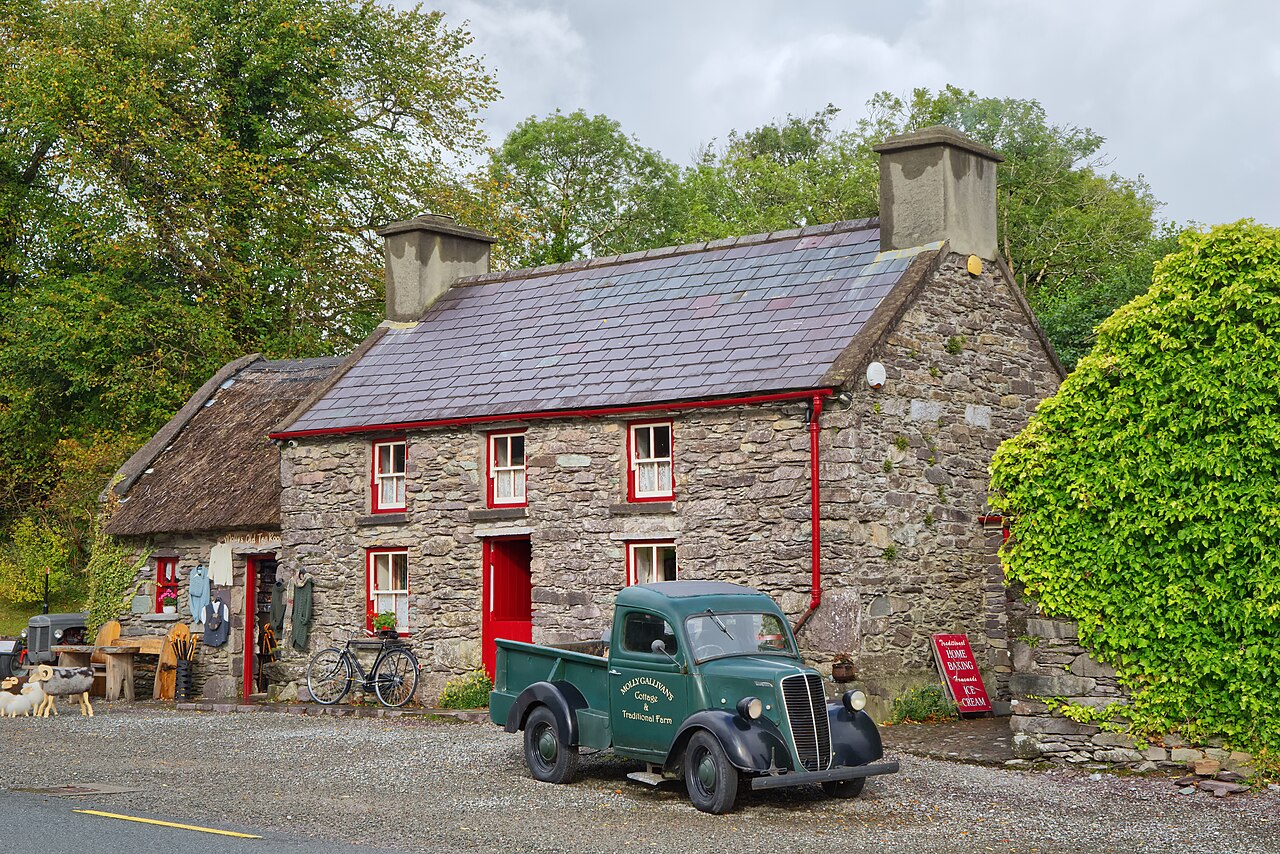
Molly Gallivan's Cottage and Traditional Farm. A 200-year-old stone cottage and small working farm at Bonane, about 10 kilometres south of Kenmare on the N71 towards Glengarriff. The farm runs as a heritage site with the cottage furnished as it would have been in the 19th century, demonstrations of bread-making over an open fire, a craft shop and short marked walks on the surrounding land. It is open daily during the main season; check current hours before travelling out of season.
Sneem. A small village built around two greens on either side of the Sneem River. The pyramidal stone sculptures in the South Square, locally known as "the Pyramids", were installed in 1990 and are a Sneem landmark in their own right.
Cahersiveen. The largest town on the western side of the peninsula. Just outside the town are the Cahergall and Leacanabuaile stone forts, both early medieval, and the ruined O'Connell Memorial Church, built in 1888 in memory of Daniel O'Connell, who was born nearby at Carhen.
Where the coaches don't go
The Gap of Dunloe — a narrow glacial valley between the MacGillycuddy's Reeks and the Purple Mountain range — sits just off the Ring near Beaufort. The road through it is single-track and tour coaches do not use it. Visitors traditionally walk or cycle the 11 kilometres from Kate Kearney's Cottage to Lord Brandon's Cottage; jaunting-car (pony and trap) hire is also available from operators based at Kate Kearney's. Combined with an open boat across the Upper, Middle and Lower Lakes of Killarney back to Ross Castle, this makes a full-day alternative to driving the full Ring in one go and is sold by several Killarney operators as the "Gap of Dunloe tour".
Walking the route
The Kerry Way is the long-distance walking route that broadly follows the line of the Ring of Kerry but on inland farm tracks, green roads and forest paths rather than the N70. It is a National Waymarked Trail of around 200 kilometres, usually walked in nine stages over nine days starting and finishing in Killarney. Stages can be walked in either direction; most guidebooks recommend anti-clockwise to keep the prevailing wind at your back. Accommodation in the villages along the route — Glenbeigh, Cahersiveen, Waterville, Caherdaniel, Sneem and Kenmare — needs to be booked ahead in summer.
Practical notes
Fuel and services. Fill up in Killarney, Kenmare or Cahersiveen — pumps are sparse on the western stretches and several smaller villages have no petrol station at all. ATMs are reliable in the same three towns; cash is still useful at honesty boxes and some smaller heritage sites.
Driving conditions. The Ring is a public road shared with farm traffic, cyclists and walkers. Many stretches between Caherdaniel and Sneem are narrow with stone walls close to the carriageway. Hire-car drivers from outside Ireland should remember that traffic drives on the left; speed limits are signed in kilometres per hour.
Mobile coverage. Coverage drops out around Coomakista Pass, in parts of the Black Valley and on stretches of the Skellig Ring. Download offline maps before you set off.
Season. The road itself is open year-round. Most boat trips to the Skelligs, the jaunting-car operators at the Gap of Dunloe, and the OPW visitor centres at Muckross House and Derrynane House operate on shorter hours from October to March, and several seasonal businesses close completely between November and Easter. Verify opening times with each operator before travelling in the shoulder season.
Public transport. Bus Éireann route 279 links Killarney with Cahersiveen and the western villages year-round but with limited daily services; the route is not designed for sightseeing in a day. Local Link Kerry runs additional rural services, including the 280 between Kenmare and Sneem.