Slea Head Drive, County Kerry: One of Ireland's Most Remote Road Journeys
A 50-kilometre loop around the western tip of the Dingle Peninsula — forts, oratories, a working Gaeltacht, the Blasket Islands and a film-famous beach, all in a single day.
The Dingle Peninsula's Western Edge
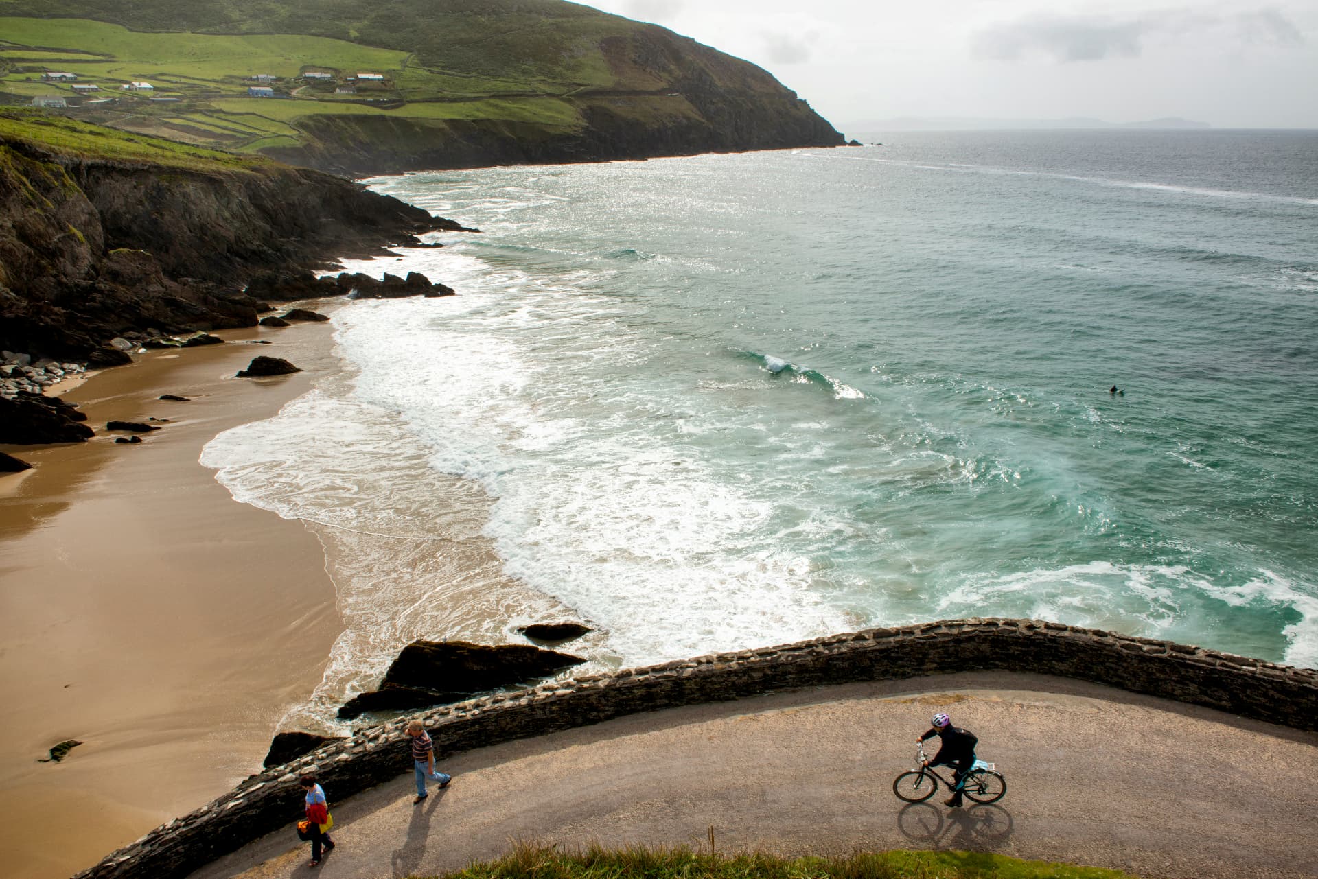
The Slea Head Drive is a circular route of approximately 50 kilometres that traces the western end of the Dingle Peninsula in County Kerry — home to the most westerly point of mainland Ireland. The drive begins and ends in Dingle town, passing through a landscape that manages to contain, within a single day's journey, cliffs of extraordinary height, Iron Age promontory forts, early Christian oratories, ancient stone monuments, a beach that has featured in major Hollywood films, and a community in which the Irish language is spoken as the first language of daily life.
What distinguishes Slea Head from other dramatic coastal drives in Kerry is the density of layers it contains — the landscape is not simply beautiful, it is culturally and historically saturated, and the two dimensions reinforce each other in a way that makes it more rewarding the slower you travel and the more time you allow.
The Road and What It Passes
Leaving Dingle westward on the R559, the drive moves quickly into the Corca Dhuibhne Gaeltacht — the Irish-speaking community of west Kerry, where the signs are in Irish, the conversations in the shops and pubs are primarily in Irish, and the sense of being in a place with a continuous cultural and linguistic heritage stretching back before the Norman invasion is immediately apparent. On the northern stretch of the loop sits the Gallarus Oratory — a remarkably well-preserved early Christian stone church, built in the corbelled dry-stone technique, that has stood in a field on the slopes above Smerwick Harbour for well over a thousand years. It remains structurally intact because the corbelled technique — stones overlapping inward to create a self-draining vault — is inherently waterproof and self-supporting.
Dunmore Head, the most westerly point of mainland Ireland, is accessible on foot from the road — a walk of about 15 minutes across rough ground to a headland from which, on a clear day, the Blasket Islands are visible in the middle distance and beyond them only the Atlantic until North America. The Blasket Islands — Great Blasket, Beginish, Inis Tuaisceart and their smaller siblings — were inhabited until 1953, when the last 22 remaining islanders were evacuated to the mainland. The literature they produced — Tomás Ó Criomhthain's The Islandman, Peig Sayers's Peig, Muiris Ó Súilleabháin's Twenty Years a-Growing — constitutes one of the most significant bodies of autobiography in the Irish language, documenting a way of life on the edge of the Atlantic that was already disappearing when it was written.
Dunbeg Fort — a promontory fort of Iron Age origin, reduced to its outer stone ramparts but still communicating the combination of defensive intent and dramatic setting that characterised the fort builders' approach to the Atlantic coastline — overlooks the sea from its headland position west of Ventry. Coumeenoole Beach, at the foot of the cliffs below Slea Head itself, was used as a filming location for Ryan's Daughter and is one of the more visually memorable beaches in Kerry — a sheltered cove at the foot of dramatic cliffs, the Blaskets visible offshore, accessible by a path from the car park above.
Dingle Town: The Base You Return To
Dingle — or An Daingean — is the natural base for the Slea Head Drive and, for many visitors, the reason to stay on the peninsula for more than a single day. The town has a food scene disproportionate to its size — the combination of the fishing port's daily catch and the concentration of genuinely good restaurants in a small town has produced a reputation for seafood that draws food tourists specifically. The fishing pier, the colourful shopfronts, the pubs with traditional music sessions and the particular atmosphere of a town at the western end of a peninsula, facing into the Atlantic with its back to the rest of Ireland, give Dingle a character that is difficult to replicate.
Fungie and the Dolphins Today
Fungie the dolphin — the solitary bottlenose dolphin who lived in Dingle Harbour from 1983 until 2020 and became one of the best-loved wild animals in Irish tourism — is no longer present, having disappeared in October 2020. The boat trips that went out to see him have continued as dolphin-watching excursions in the wider harbour and bay, and dolphins are seen regularly in the waters around the Dingle Peninsula even without the guaranteed close encounter that Fungie provided.
The Bottom Line
The Slea Head Drive is one of the most layered day routes in Ireland — a 50-kilometre circuit of the Dingle Peninsula's western tip that passes through an Iron Age fort, an early Christian stone oratory, a working Gaeltacht, the most westerly point of mainland Ireland, a beach that has been in a Hollywood film and the closest mainland viewpoint to the Blasket Islands and the literature that came from them. Dingle as a base adds a food and music dimension that makes the whole peninsula worth two days rather than one. Do not rush it. The road is narrow, the landscape is dense, and the things you stop to look at will take longer than you planned.