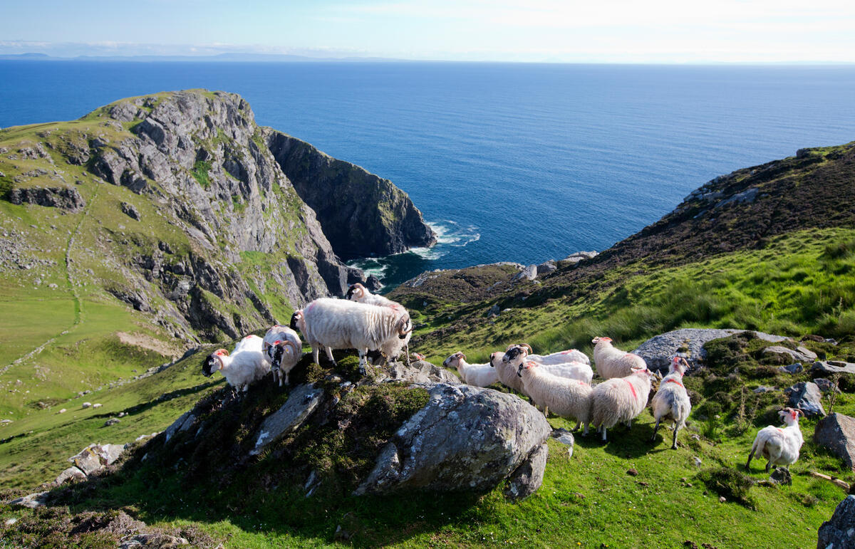
Ireland's Northwest is the corner of the country where the Wild Atlantic Way stops being a scenic drive and starts feeling like an edge. The 2,500-kilometre coastal route, launched by Fáilte Ireland in 2014 and still the longest defined coastal touring route in the world, runs from Kinsale in County Cork all the way to Malin Head in County Donegal — and it is in the upper reaches, through Sligo, Leitrim and Donegal, that the landscape is at its most dramatic and the crowds at their thinnest.
For tourism purposes the Northwest is built around two counties: Sligo and Donegal. Between them they hold some of the oldest archaeology, the highest sea cliffs and the largest Gaeltacht — Irish-speaking — region in the country.
Slieve League and the Donegal Cliffs
The Slieve League cliffs in southwest Donegal rise to 601 metres above the Atlantic — almost three times the height of the Cliffs of Moher in County Clare. They are among the highest accessible sea cliffs in Europe. A walking path climbs from the upper car park along the ridge known as One Man's Pass to the summit, with the Atlantic dropping vertically away on one side and the green slopes of the Sliabh Liag peninsula falling to Donegal Bay on the other.
The newer Sliabh Liag Cliffs visitor centre at Teelin, opened in 2022, has interpretive exhibits, a café and a shuttle bus service to the upper viewing platform. Boat tours from Teelin pier run out under the cliffs from April to October, weather permitting, and remain the only way to see the full scale of the rock face from the water.
The Gaeltacht Coast
Much of west Donegal — from Gweedore (Gaoth Dobhair) through Bunbeg, Derrybeg and the islands of Arranmore and Tory — falls within the Donegal Gaeltacht, the largest area in Ireland where Irish remains the everyday community language. Road signs are in Irish only. Schools, shops and pubs operate through Irish first. Tory Island, nine miles offshore, has its own elected king, a tradition unbroken for centuries.
The coast here is a chain of white-sand beaches, low headlands and granite outcrops, with the conical peak of Errigal — Donegal's highest mountain at 751 metres — dominating the interior. Glenveagh National Park, just inland, protects 16,000 hectares of mountain, bog and the second-largest red deer herd in the country, around a Victorian castle built in the 1870s.
Sligo and Yeats Country
South of Donegal Bay, County Sligo is the landscape that shaped W. B. Yeats. The flat-topped silhouette of Benbulben rises 526 metres out of the coastal plain north of Sligo town and appears in poem after poem; Yeats is buried beneath it, in Drumcliffe churchyard, under the epitaph he wrote himself: "Cast a cold eye on life, on death. Horseman, pass by."
Sligo also holds one of the densest concentrations of megalithic monuments in Europe. The Carrowmore complex, just outside Sligo town, contains more than 30 surviving tombs and is one of the four largest megalithic cemeteries in the country. Carrowkeel, on the slopes of the Bricklieve Mountains to the south, is a cluster of fourteen passage tombs aligned to the summer solstice and predates the pyramids of Giza by several centuries.
Surf, Sand and the Atlantic
The same Atlantic swells that tear at the Donegal cliffs make the Northwest one of the best cold-water surf destinations in Europe. Bundoran in south Donegal is the country's established surf capital — host of multiple stages of the European surf tour and home to the famous reef break known as The Peak. Strandhill in Sligo, Easkey along the Sligo coast, and Rossnowlagh and Tullan Strand in Donegal all hold consistent waves through autumn and winter, with surf schools running year-round.
For those who prefer their water flat, Mullaghmore Head in north Sligo is one of the most photographed headlands in Ireland — a long crescent of beach beneath the silhouette of Classiebawn Castle, with Benbulben rising behind.
Practical Notes
Sligo town and Donegal town are the natural bases. Sligo is reached by direct rail from Dublin in just over three hours; Donegal is best accessed by car or by the Bus Éireann Expressway service. The City of Derry Airport, just over the border in Northern Ireland, is the closest international airport to north Donegal and has summer connections to several UK and European cities.
The weather is honestly Atlantic — clear mornings turn to driving rain by mid-afternoon and back again before sunset. Bring waterproofs and accept that the light, when it comes, is the reason photographers love this coast.
Ireland's Northwest is not the part of the country that sells itself on Instagram. It is bigger, wilder and emptier than that, and it asks a little more of the visitor who comes here. The reward is a stretch of coast that, even in the middle of a record tourism year for Ireland, still feels like it belongs to the people who live on it.