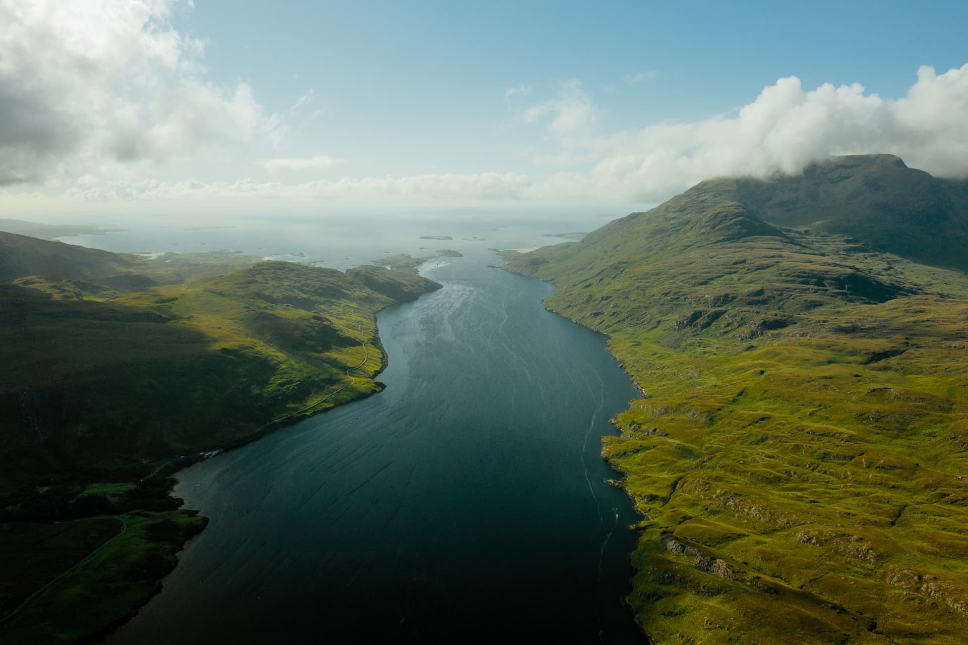
Seen from the air in the photograph above, Killary is a long inlet of dark-blue water running away toward the sea, green and rocky slopes rising on both sides, cloud pressed against the higher mountain on the right, and a handful of low islands lying at the distant mouth under a pale sky. The water does not sprawl. It holds a line, straight and purposeful, as if it knows exactly where it is going. That discipline is the first clue to what this place is, and the reason it repays patience. Killary Fjord forms the natural border between Galway and Mayo, a single reach of sea that two counties share. It is grand, but it is also legible. This is a landscape that explains itself to anyone prepared to read it, first from the water and then from the shore.
A Valley the Ice Made and the Sea Took Back
Geological Survey Ireland describes Killary as a glacial U-shaped valley drowned by the sea. The phrase is worth unpacking, because it changes how the whole scene looks. Imagine the water drained away and the shape becomes plain: a broad trough with steep flanks, ground out by moving ice, later flooded when the sea pushed in. What reads at first glance as a harbour is really a valley floor seen through a lid of salt water. A boat crossing Killary today floats above ground that ice once scoured.
That is why the mountains matter so much here. Mweelrea rises on the north side. To the south stand the Twelve Bens and the Maumturk Mountains. They are not a backdrop to the water; they are the other half of the same form. The slopes and the inlet belong to one continuous curve, and the eye can follow it down from the high ground to the waterline and imagine it carrying on beneath the surface. Tourism Ireland calls Killary a glacial fjord, and the word fits. It names the meeting of two forces, ice that carved and sea that filled, still visible in a single sweep of land.
The View From the Water
The fullest way to feel the valley's proportions is from its surface. According to Killary Fjord Boat Tours, the Connemara Lady runs 90-minute sightseeing cruises from Nancy's Point, on the south shore west of Leenane. The boat has a cabin and outside decks, which offers a choice of how to meet the place: behind glass, with the slopes framed like a slow film, or out in the open, where the mountains seem to lean in on either side.
From the middle of the channel, the scale shifts. Seen from land, mountains are mass, something to look up at. From the water they become walls, and the inlet becomes a long room with the sky for a ceiling. The glacial shape that sounds abstract in a geological report turns physical: the steepness of the flanks, the way the water fills the trough from side to side, the sense of being carried along the floor of a valley rather than across an open bay. Light and cloud will do whatever they do on a given afternoon, but the architecture holds.
It is worth going aboard with the right expectations. The reason to book is the landscape itself rather than a promise of wildlife or a particular sea state. The reward is perspective: ninety minutes to see the valley as a whole, from the angle that makes its origins easiest to grasp.
Leenane, the Shoreline and a Working Landscape
Leenane lies toward the inland end of Killary, well away from the Atlantic mouth. That position shapes the mood. Here the open sea is a distant idea at the far end of the corridor, and the water reads as part of the valley around it. For anyone arriving by road, this inland end makes a natural threshold, a place to pause before the shoreline and the boat.
Killary is no museum piece. Mayo County Council notes shellfish farming on the fjord, and the ropes used to grow mussels are visible on the water. They are easy to overlook at first, and then hard to stop noticing: quiet geometry laid across a surface the ice prepared long ago. They are a reminder that this landscape is used as well as admired, and that the water feeds people as surely as it frames views.
Older labour is written into the southern shore, too. The Connemara Mountain Walking Festival describes a rocky trail along that side of the fjord that originated as nineteenth-century relief work. Walking it means following a line made by hands at work in hard times, and that knowledge changes the ground underfoot. The path is not a decorative trail laid for visitors. It is a record, and treating it as one adds weight to every uneven step.
Planning an Unhurried Visit
Killary rewards a slow day more than a crowded one. The operator's published sailing season runs from April to October, and Discover Ireland's listing for the boat tours states that pre-booking is essential. For anyone travelling late in October, a sailing is not something to assume; the booking calendar is the place to confirm availability before setting out, and it is sensible to confirm the meeting point at Nancy's Point at the same time.
The shoreline asks for a little preparation. The southern trail is rocky, and route conditions, access and local weather all deserve checking before a walk. Sturdy footwear is the minimum; uneven ground is part of the character. One local activity provider offers a boat transfer to Rosroe so walkers can make their way back on foot, with rough and uneven sections, but that service runs from June to August only, so it is not an option in October. Anyone hoping to walk the shore outside summer will want to plan their own route and confirm current access locally, rather than relying on an arrangement that only operates in summer.
The richest plan may also be the simplest: one valley, seen two ways. Time on the water shows the whole shape at once; time on the shore shows its texture, from the mussel ropes on the surface to the stones of an old relief road. Leaving room between the two, without hurrying from one to the next, lets the landscape settle into something more than scenery.
The Bottom Line
Killary Fjord is a glacial valley the sea has claimed, framed by Mweelrea to the north and the Twelve Bens and Maumturks to the south, and shared between Galway and Mayo. A 90-minute cruise from Nancy's Point reveals its form, the shore near Leenane shows how it is lived in and worked, and the rocky southern trail carries the memory of nineteenth-century relief labour. Book ahead, check the sailing calendar and local conditions, and arrive ready to look slowly. Killary gives most to visitors who take time to understand how the ice and the sea shaped it.