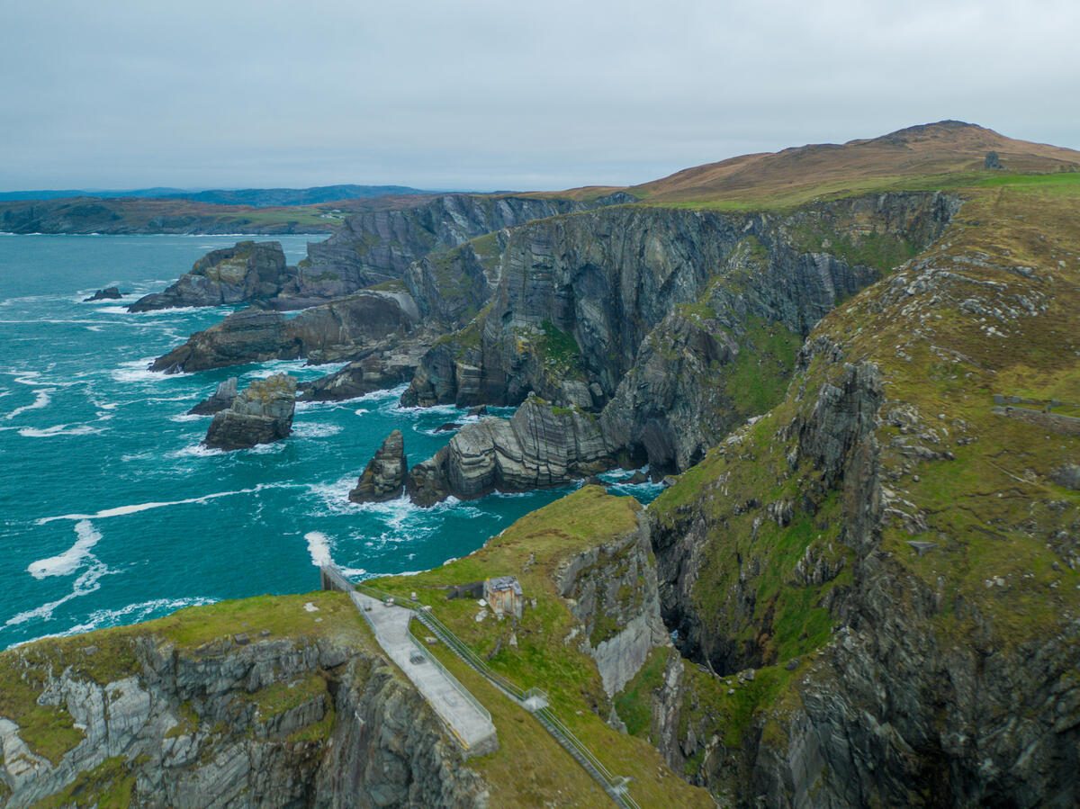
Ireland has four cardinal extremities, and Mizen Head is the most south-westerly of them. The headland sits on the Mizen Peninsula in West Cork, roughly two hours south-west of Cork city by road. It is owned by Cork County Council and run as a visitor attraction by Mizen Tourism Co-operative; the eircode is P81 NY52.
What is actually there
The headland's principal structure is a fog signal station completed in 1909 by the Commissioners of Irish Lights to warn shipping of the cliffs after a series of nineteenth-century wrecks on this stretch of coast. The station and its outbuildings sit on a small islet separated from the mainland cliff by a deep gully.
To reach it, visitors descend a flight of 99 steps and cross an arched concrete footbridge spanning the gully. The original bridge was opened in 1910 — among the earliest reinforced-concrete arch bridges built in Ireland — and was replaced in 2010 with a near-identical structure to the same proportions, after corrosion of the steel reinforcement made the original unsafe. The replacement is the bridge visitors cross today.
The Marconi connection
The Italian wireless pioneer Guglielmo Marconi worked along this coast in the early 1900s, including transmissions between Crookhaven, the Fastnet Rock lighthouse 13 kilometres offshore, and shipping in the Atlantic approaches. The signal station's restored Marconi Room contains period telegraphic equipment and tells the story of how the Fastnet, visible from Mizen on a clear day, became one of the first lighthouses in the world to use Marconi's wireless system.
Wildlife
The waters off Mizen are part of one of Ireland's richest cetacean corridors. Common dolphins, harbour porpoises and minke whales are regularly recorded between spring and autumn; humpbacks and fin whales appear later in the year. Choughs — the red-legged, red-billed crow that has become a symbol of west-coast cliffs — nest in the surrounding rock faces. Patient visitors with binoculars and a flask have a real chance of seeing all of the above on a calm day.
Practicalities
The site is open daily from 21 March 2026 (the eCentre operates 11am–4pm); when the site is closed, the whole headland is locked, as it is private property. There is a car park, café and visitor centre at the entrance. The walk down the 99 steps and across the bridge to the signal station and back takes most people 45 minutes to an hour at an unhurried pace.
The route is steep and exposed — the cliffs here drop sharply to the Atlantic — and the wind can be strong even on bright days. Sturdy footwear and a windproof layer are sensible. The path is not suitable for wheelchairs, though the upper visitor centre and viewing terraces are accessible.
Pairing it with the rest of West Cork
Mizen sits at the end of one of Ireland's quietest peninsulas. Schull, with its sailing harbour and a small but excellent food scene, is half an hour back along the R592. Goleen and Crookhaven, the village from which Marconi sent his first commercial transatlantic messages, are both within fifteen minutes. Most visitors do Mizen as a long half-day from Schull or Bantry, or as the turning point of a Wild Atlantic Way drive between Kinsale and the Beara Peninsula.
It is the corner of Ireland furthest from Dublin. On a clear day, with the Fastnet Rock on the horizon and a chough riding the updraft from the cliff below, it feels exactly that.